Blakely Raise [Kinniside] Stone Circle - 1959
Introduction
The photograph on this page of Blakely Raise [Kinniside] Stone Circle - 1959 by M J Richardson as part of the Geograph project.
The Geograph project started in 2005 with the aim of publishing, organising and preserving representative images for every square kilometre of Great Britain, Ireland and the Isle of Man.

There are currently over 7.5m images from over 14,400 individuals and you can help contribute to the project by visiting https://www.geograph.org.uk
Blakely Raise [Kinniside] Stone Circle - 1959
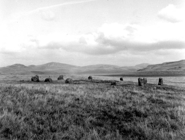
Image: © M J Richardson Taken: Unknown
A stone circle by the roadside at Scarny Brow, south of Ennerdale Bridge. It is noted as restored; Humphrey Bolton Image suggested it might be modern but Maggie and Keith Davison http://www.megalithics.com/ have told me that 'the circle was completely dismantled by local farmers to use the stones for gateposts and building stone. Just after WW1 the stone sockets were found and the stones re-erected, supposedly exactly as the used to be, but we heard rumours that at least one was known to be upside down.' See also http://www.megalithic.co.uk/article.php?sid=327 .
Images are licensed for reuse under creativecommons.org/licenses/by-sa/2.0
Image Location
Latitude
54.512826
Longitude
-3.453298