Coed Helen
Introduction
The photograph on this page of Coed Helen by Rude Health as part of the Geograph project.
The Geograph project started in 2005 with the aim of publishing, organising and preserving representative images for every square kilometre of Great Britain, Ireland and the Isle of Man.

There are currently over 7.5m images from over 14,400 individuals and you can help contribute to the project by visiting https://www.geograph.org.uk
Coed Helen
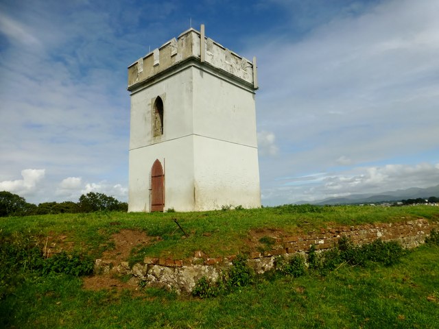
Image: © Rude Health Taken: 15 Aug 2015
A lovely view point on a sunny Saturday in August with Paul Webster. Name: Coed Helen Hill number: 14852 Height: 48m / 157ft Parent (Ma/M): 2000 Moel Eilio Section: 30A: Anglesey and the Lleyn Peninsula County/UA: Gwynedd (CoU) Class: Tump (0-99m) Grid ref: SH 47601 62399 Summit feature: ground at base of tower Drop: 30m Col: 18m SH476621
Images are licensed for reuse under creativecommons.org/licenses/by-sa/2.0
Image Location
Latitude
53.136891
Longitude
-4.279638