Lodge Street, Bristol
Introduction
The photograph on this page of Lodge Street, Bristol by Derek Harper as part of the Geograph project.
The Geograph project started in 2005 with the aim of publishing, organising and preserving representative images for every square kilometre of Great Britain, Ireland and the Isle of Man.

There are currently over 7.5m images from over 14,400 individuals and you can help contribute to the project by visiting https://www.geograph.org.uk
Lodge Street, Bristol
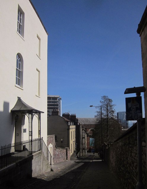
Image: © Derek Harper Taken: 22 Mar 2015
On the immediate left is the side of an end terrace of Lower Park Row, with an early C19 wrought-iron tented porch with batswing spandrels" http://list.historicengland.org.uk/resultsingle.aspx?uid=1206449&searchtype=mapsearch . The attached house http://list.historicengland.org.uk/resultsingle.aspx?uid=1202359&searchtype=mapsearch and terrace http://list.historicengland.org.uk/resultsingle.aspx?uid=1206287&searchtype=mapsearch down the street are also listed .
Images are licensed for reuse under creativecommons.org/licenses/by-sa/2.0
Image Location
Latitude
51.455257
Longitude
-2.599095