Bethel Baptist Chapel
Introduction
The photograph on this page of Bethel Baptist Chapel by Humphrey Bolton as part of the Geograph project.
The Geograph project started in 2005 with the aim of publishing, organising and preserving representative images for every square kilometre of Great Britain, Ireland and the Isle of Man.

There are currently over 7.5m images from over 14,400 individuals and you can help contribute to the project by visiting https://www.geograph.org.uk
Bethel Baptist Chapel
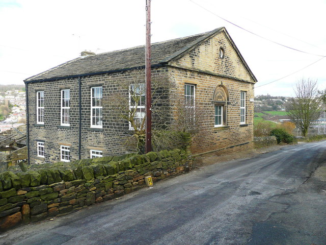
Image: © Humphrey Bolton Taken: 23 Mar 2015
No longer a chapel, and converted to a house. It was opened in 1865, and closed in 1958 due to dry rot. The last service was held on 29th December 1958. (Information from Malcolm Bull's Calderdale Companion)
Images are licensed for reuse under creativecommons.org/licenses/by-sa/2.0
Image Location
Latitude
53.706356
Longitude
-1.899981