The Castle, Green Lanes
Introduction
The photograph on this page of The Castle, Green Lanes by Marathon as part of the Geograph project.
The Geograph project started in 2005 with the aim of publishing, organising and preserving representative images for every square kilometre of Great Britain, Ireland and the Isle of Man.

There are currently over 7.5m images from over 14,400 individuals and you can help contribute to the project by visiting https://www.geograph.org.uk
The Castle, Green Lanes
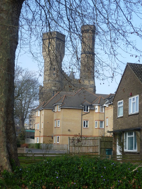
Image: © Marathon Taken: 18 Mar 2015
The Castle was built in 1855 as a pumping station. Victorians though wanted to make it a building of distinction so added turrets and battlements. After ceasing to be used for its original purpose it is now an indoor climbing centre. It is seen here from the junction of Green Lanes with Lordship Park.
Images are licensed for reuse under creativecommons.org/licenses/by-sa/2.0
Image Location
Latitude
51.565192
Longitude
-0.092512