87 High Street, Kelvedon
Introduction
The photograph on this page of 87 High Street, Kelvedon by Robin Webster as part of the Geograph project.
The Geograph project started in 2005 with the aim of publishing, organising and preserving representative images for every square kilometre of Great Britain, Ireland and the Isle of Man.

There are currently over 7.5m images from over 14,400 individuals and you can help contribute to the project by visiting https://www.geograph.org.uk
87 High Street, Kelvedon
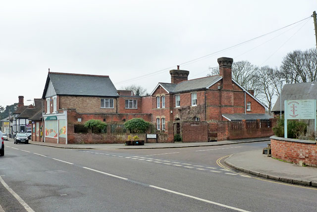
Image: © Robin Webster Taken: 15 Feb 2015
This was the parsonage for the chapel whose name board may just be seen on the other corner of New Road. It seems to date from about 1900. Previously there was a 'Manse' mapped here in the 1870s, but a later mapping in the 1890s shows a vacant site, so this is presumably a replacement. Beyond is a Co-op Foodstore.
Images are licensed for reuse under creativecommons.org/licenses/by-sa/2.0
Image Location
Latitude
51.836176
Longitude
0.699298