Huddersfield, Page Street
Introduction
The photograph on this page of Huddersfield, Page Street by David Dixon as part of the Geograph project.
The Geograph project started in 2005 with the aim of publishing, organising and preserving representative images for every square kilometre of Great Britain, Ireland and the Isle of Man.

There are currently over 7.5m images from over 14,400 individuals and you can help contribute to the project by visiting https://www.geograph.org.uk
Huddersfield, Page Street
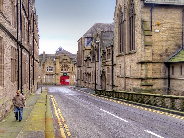
Image: © David Dixon Taken: 5 Jan 2015
Looking along Page Street. The buildings on either side date from approx the 1880s and are Grade II-listed. To the left, the Ramsden Building (old Technical College, now part of the University - English Heritage Building ID: 406611 http://www.britishlistedbuildings.co.uk/en-406611-ramsden-building-at-huddersfield-polytec ); to right are the Milton Congregational Chapel and Sunday School buildings (English Heritage Building IDs: 406613 and 404504, http://www.britishlistedbuildings.co.uk/en-406613-milton-congregational-church- and http://www.britishlistedbuildings.co.uk/en-404504-milton-congregational-chapel-sunday-scho ) The building at the end of the street, with the red door, appears to be of a similar age. It is a Territorial Army Centre; the board above the door reads: "C Company 4th Battalion The Yorkshire Regiment"
Images are licensed for reuse under creativecommons.org/licenses/by-sa/2.0
Image Location
Latitude
53.64256
Longitude
-1.77988