Watermill Road
Introduction
The photograph on this page of Watermill Road by Anne Burgess as part of the Geograph project.
The Geograph project started in 2005 with the aim of publishing, organising and preserving representative images for every square kilometre of Great Britain, Ireland and the Isle of Man.

There are currently over 7.5m images from over 14,400 individuals and you can help contribute to the project by visiting https://www.geograph.org.uk
Watermill Road
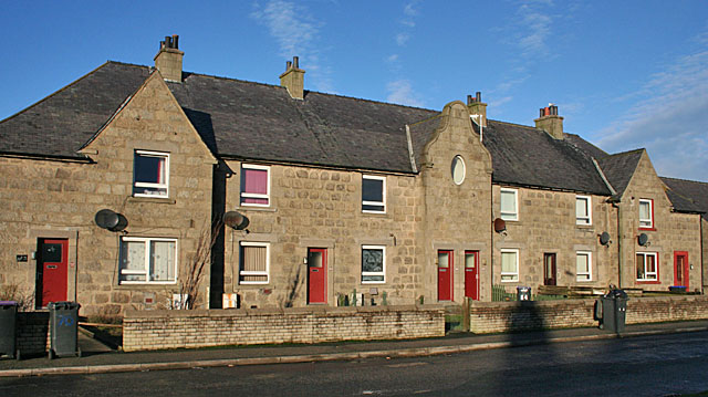
Image: © Anne Burgess Taken: 6 Jan 2015
There is a row of council-built houses on the north side of Watermill Road. They are much more pleasing to look at than the average council estate, being solidly built of stone and with interesting architectural detail, such as the Dutch gable in the centre of this block.
Images are licensed for reuse under creativecommons.org/licenses/by-sa/2.0
Image Location
Latitude
57.693907
Longitude
-2.020451