Primary school reception entrance, Heol-y-cyw
Introduction
The photograph on this page of Primary school reception entrance, Heol-y-cyw by Jaggery as part of the Geograph project.
The Geograph project started in 2005 with the aim of publishing, organising and preserving representative images for every square kilometre of Great Britain, Ireland and the Isle of Man.

There are currently over 7.5m images from over 14,400 individuals and you can help contribute to the project by visiting https://www.geograph.org.uk
Primary school reception entrance, Heol-y-cyw
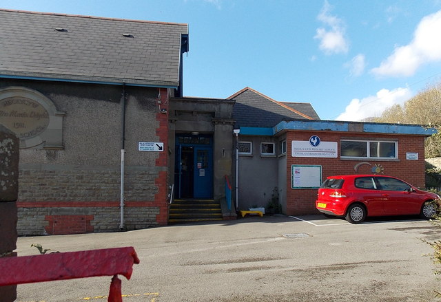
Image: © Jaggery Taken: 14 Nov 2014
Viewed from the west side of High Street. On the left, an oval inscription on the wall shows the year 1911 and the spelling HEOLYCYW (no spaces or hyphens). Though the name on the right is HEOL-Y-CYW PRIMARY SCHOOL, this site is now part of Pencoed Primary School. The main school buildings are in Pencoed about 3km away. http://www.geograph.org.uk/photo/4240947
Images are licensed for reuse under creativecommons.org/licenses/by-sa/2.0
Image Location


Leaflet Map data © OpenStreetMap
Latitude
51.548605
Longitude
-3.522181