Arkleston Court: demolition in progress
Introduction
The photograph on this page of Arkleston Court: demolition in progress by Lairich Rig as part of the Geograph project.
The Geograph project started in 2005 with the aim of publishing, organising and preserving representative images for every square kilometre of Great Britain, Ireland and the Isle of Man.

There are currently over 7.5m images from over 14,400 individuals and you can help contribute to the project by visiting https://www.geograph.org.uk
Arkleston Court: demolition in progress
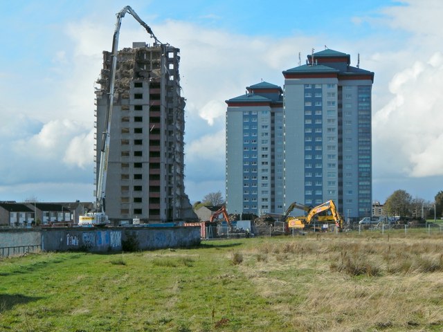
Image: © Lairich Rig Taken: 3 Nov 2014
A picture taken in January of the same year shows the building intact: Image The other two high flats in the picture are Image (the nearer of the two) and Image All three buildings are on Image, in the Gallowhill area of Paisley. The photograph of the road also includes Arkleston Court in the background. For another picture of the demolition, taken on the same day, but from a different location, see Image The present view is from the roadside, on the boundary between Arkleston (to the east) and Gallowhill (to the west). For those areas and their names, see, respectively, Image and the last section of the description of Image
Images are licensed for reuse under creativecommons.org/licenses/by-sa/2.0
Image Location
Latitude
55.859777
Longitude
-4.404889