Former Colliery Houses
Introduction
The photograph on this page of Former Colliery Houses by Mary and Angus Hogg as part of the Geograph project.
The Geograph project started in 2005 with the aim of publishing, organising and preserving representative images for every square kilometre of Great Britain, Ireland and the Isle of Man.

There are currently over 7.5m images from over 14,400 individuals and you can help contribute to the project by visiting https://www.geograph.org.uk
Former Colliery Houses
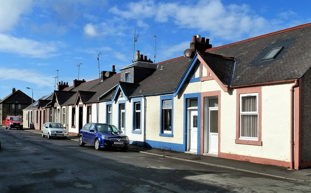
Image: © Mary and Angus Hogg Taken: 10 Oct 2014
The houses in this area were built to accommodate local coal miners and were far ahead of their time in design and construction, significantly better than the typical miners' rows found elsewhere. This view shows Maxwell Street. The miners worked in the pits around Dailly, a few miles inland. Other well-built colliery houses can be seen at Dalmellington - Image
Images are licensed for reuse under creativecommons.org/licenses/by-sa/2.0
Image Location


Leaflet Map data © OpenStreetMap
Latitude
55.245291
Longitude
-4.849724