Castle Mill basin, Dudley canal
Introduction
The photograph on this page of Castle Mill basin, Dudley canal by Rudi Winter as part of the Geograph project.
The Geograph project started in 2005 with the aim of publishing, organising and preserving representative images for every square kilometre of Great Britain, Ireland and the Isle of Man.

There are currently over 7.5m images from over 14,400 individuals and you can help contribute to the project by visiting https://www.geograph.org.uk
Castle Mill basin, Dudley canal
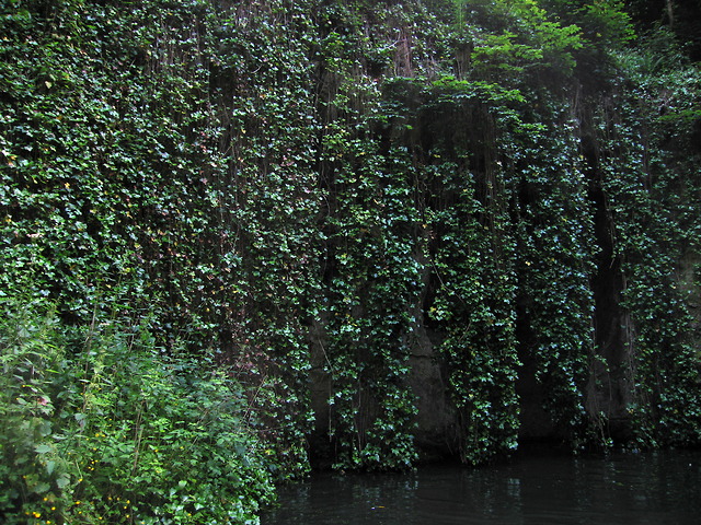
Image: © Rudi Winter Taken: 8 Jun 2014
Castle Mill basin is a former underground limestone mine cavern which was widened to enable canal boats to turn about 90 degrees from the Dudley tunnel (south) to the much shorter Tipton tunnel (east) effectively "inside" Castle Hill. Now open to the sky, the vertical cliff faces surrounding it are covered in vegetation. Castle Hill and nearby Wren's Nest are anticlines of Silurian limestone layers protruding from the surrounding Carboniferous coal beds. Both the limestone and the coal were quarried from the beginning of the industrial revolution and used in the iron smelting industry of the West Midlands of England. Mining finally ceased in 1920. The Dudley canal was completed in 1791, running in a tunnel under Castle Hill for nearly 3km in a SSW direction. Several branch canals were built around the same time to access the limestone seams in the Castle Hill anticline, which run roughly SSE. In addition, there is a westerly branch leading to Wren's Nest. Multiple caverns have been excavated inside Castle Hill, some of which up to 800m in length. Many of the caverns have had roof collapses and rock falls and have since been backfilled. However, some are still accessible by boat through the original tunnels and a few new link tunnels built in the 1980s to enable the Dudley Canal Trust to run circular tours for visitors to see the mines. A schematic map of the canal system is shown on the Trust's website https://web.archive.org/web/20150101180643/http://www.dudleytunnel.co.uk/mines.html (archive link).
Images are licensed for reuse under creativecommons.org/licenses/by-sa/2.0
Image Location
Latitude
52.522339
Longitude
-2.082048