
Oldbury Locks
Introduction
The photograph on this page of Oldbury Locks by Stephen McKay as part of the Geograph project.
The Geograph project started in 2005 with the aim of publishing, organising and preserving representative images for every square kilometre of Great Britain, Ireland and the Isle of Man.

There are currently over 7.5m images from over 14,400 individuals and you can help contribute to the project by visiting https://www.geograph.org.uk
Oldbury Locks
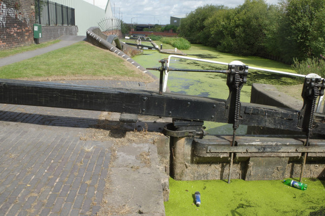
Image: © Stephen McKay Taken: 9 Aug 2014
There are six locks here leading up from the BCN (Birmingham Canal Navigations) old main line to the highest point on the BCN network - a summit level at 511ft. This is really a canal strictly for enthusiasts - after coming up the locks through industrial surroundings there is nothing much to do other than turn round and go back down again. The pond weed and rubbish in the water are testimony to the lack of use. Still, the locks are not heavy and, for the observant, there is plenty of interest.
Images are licensed for reuse under creativecommons.org/licenses/by-sa/2.0
Image Location

Latitude
52.497825
Longitude
-2.009531