Layton Cemetery
Introduction
The photograph on this page of Layton Cemetery by Gerald England as part of the Geograph project.
The Geograph project started in 2005 with the aim of publishing, organising and preserving representative images for every square kilometre of Great Britain, Ireland and the Isle of Man.

There are currently over 7.5m images from over 14,400 individuals and you can help contribute to the project by visiting https://www.geograph.org.uk
Layton Cemetery
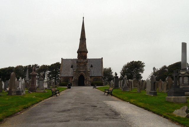
Image: © Gerald England Taken: 23 Sep 2013
Layton cemetery was opened in 1873. The cemetery is split into three main areas with the Church of England graves running through the middle, the Catholic graves running down the right hand side and the non-conformist on the left side as you stand at the main gate on Talbot Road. There is a separate Muslim section on the far left side, and situated a short distance down Westcliffe Drive is the Jewish Section. http://www.blackpool.gov.uk/Residents/Life-events/Cemeteries-and-crematorium/Layton-cemetery.aspx The cemetery was designed and laid out by Garlick, Park and Sykes, architects of Preston. Originally there were three mortuary chapels, Anglican, Catholic and Non-Conformist but only the Anglican remains.
Images are licensed for reuse under creativecommons.org/licenses/by-sa/2.0
Image Location
Latitude
53.827778
Longitude
-3.033225