Cornholme - house at Rosebery Street
Introduction
The photograph on this page of Cornholme - house at Rosebery Street by Dave Bevis as part of the Geograph project.
The Geograph project started in 2005 with the aim of publishing, organising and preserving representative images for every square kilometre of Great Britain, Ireland and the Isle of Man.

There are currently over 7.5m images from over 14,400 individuals and you can help contribute to the project by visiting https://www.geograph.org.uk
Cornholme - house at Rosebery Street
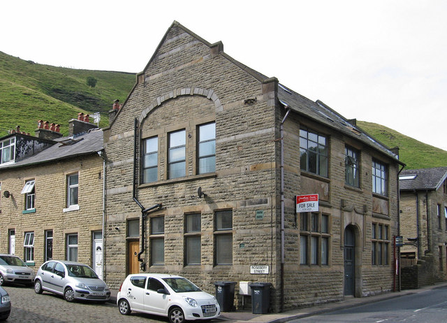
Image: © Dave Bevis Taken: 26 Jul 2014
At its junction with Burnley Road. Back in the 1800's this building was the Todmorden Liberal Club. The façade has changed a little over the years, the roofline has been altered, and it has now been converted into 2 separate dwellings (one of which was for sale in 2016). See also http://www.pennineheritage.org.uk/document/9131.
Images are licensed for reuse under creativecommons.org/licenses/by-sa/2.0
Image Location
Latitude
53.732113
Longitude
-2.138204