Bullhouse Minewater Project
Introduction
The photograph on this page of Bullhouse Minewater Project by Chris Morgan as part of the Geograph project.
The Geograph project started in 2005 with the aim of publishing, organising and preserving representative images for every square kilometre of Great Britain, Ireland and the Isle of Man.

There are currently over 7.5m images from over 14,400 individuals and you can help contribute to the project by visiting https://www.geograph.org.uk
Bullhouse Minewater Project
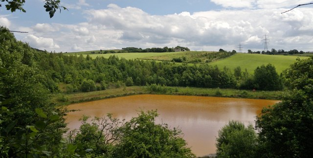
Image: © Chris Morgan Taken: 7 Jul 2014
Water running out of old mineworkings can contain high levels of ochre, turning the water orange and killing all plant life. Here the water is pumped into a large settling lagoon to allow the ochre to settle before allowing clear water to be siphoned off and flow downstream. All part of the legacy that needs managing in old coalfield areas. In this case the colliery closed in 1918, but the adit still brings this ochre laden water to the surface.
Images are licensed for reuse under creativecommons.org/licenses/by-sa/2.0
Image Location
Latitude
53.516154
Longitude
-1.685978