St Hilda's Church, South Shields
Introduction
The photograph on this page of St Hilda's Church, South Shields by Roger Cornfoot as part of the Geograph project.
The Geograph project started in 2005 with the aim of publishing, organising and preserving representative images for every square kilometre of Great Britain, Ireland and the Isle of Man.

There are currently over 7.5m images from over 14,400 individuals and you can help contribute to the project by visiting https://www.geograph.org.uk
St Hilda's Church, South Shields
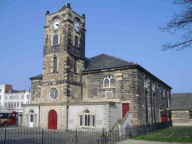
Image: © Roger Cornfoot Taken: 15 Apr 2007
See http://www.communigate.co.uk/ne/sthildassouthshields/ . Murray's Handbook (1890) mentions: The Church of St Hilda, in the market place, originally a chapelry of Jarrow, constituted an independent ecclesiastical parish in 1845, is of great antiquity, but has been so patched and altered that scarcely any of the original building remains.
Images are licensed for reuse under creativecommons.org/licenses/by-sa/2.0
Image Location


Leaflet Map data © OpenStreetMap
Latitude
54.996817
Longitude
-1.437251