Llandeilo railway station, Carmarthenshire
Introduction
The photograph on this page of Llandeilo railway station, Carmarthenshire by Nigel Thompson as part of the Geograph project.
The Geograph project started in 2005 with the aim of publishing, organising and preserving representative images for every square kilometre of Great Britain, Ireland and the Isle of Man.

There are currently over 7.5m images from over 14,400 individuals and you can help contribute to the project by visiting https://www.geograph.org.uk
Llandeilo railway station, Carmarthenshire
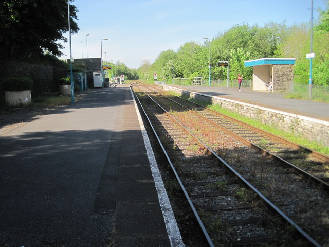
Image: © Nigel Thompson Taken: 17 May 2014
Opened in 1852 by the 'Llanelly Railway' on the line from Llanelli, the route was later extended northwards and by linking up with other lines, created a through route to Llandrindod Wells, Church Stretton and Shrewsbury. It became known as the Central Wales Line. View north east towards Talley Road Halt and Llandrindod. From 1865 to 1963, this was also the junction for the line to Carmarthen. Compared to Image from the right-hand platform, the signalbox and station buildings have both been removed,
Images are licensed for reuse under creativecommons.org/licenses/by-sa/2.0
Image Location
Latitude
51.885343
Longitude
-3.98689