Canal feeder, Tring
Introduction
The photograph on this page of Canal feeder, Tring by Robin Webster as part of the Geograph project.
The Geograph project started in 2005 with the aim of publishing, organising and preserving representative images for every square kilometre of Great Britain, Ireland and the Isle of Man.

There are currently over 7.5m images from over 14,400 individuals and you can help contribute to the project by visiting https://www.geograph.org.uk
Canal feeder, Tring
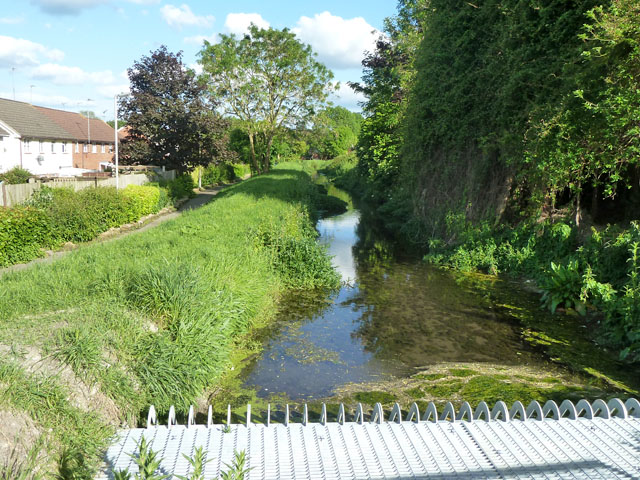
Image: © Robin Webster Taken: 25 May 2014
Looking upstream from Icknield Way, with a debris screen for passage under the road prominent. This feeds into the Wendover Arm of the Grand Union Canal. The visible section is embanked above the housing on the right, with a public footpath running along the lower level. This path has sandbags along its left side for some distance, suggesting the premises here suffered from flooding during the very wet preceding winter.
Images are licensed for reuse under creativecommons.org/licenses/by-sa/2.0
Image Location
Latitude
51.805302
Longitude
-0.660113