Fairfield, College
Introduction
The photograph on this page of Fairfield, College by Mike Faherty as part of the Geograph project.
The Geograph project started in 2005 with the aim of publishing, organising and preserving representative images for every square kilometre of Great Britain, Ireland and the Isle of Man.

There are currently over 7.5m images from over 14,400 individuals and you can help contribute to the project by visiting https://www.geograph.org.uk
Fairfield, College
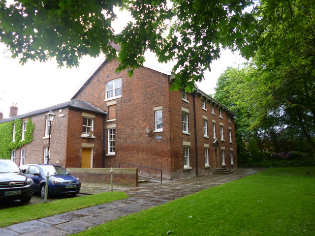
Image: © Mike Faherty Taken: 25 May 2014
At the end of Sisters' Street in the Moravian Settlement; originally the Sisters' House, later girls' boarding school, then Theological College; now Sunday School and community centre. Listed by English Heritage: http://www.imagesofengland.org.uk/Details/Default.aspx?id=212726&mode=quick http://www.moravian.org.uk/index.php/uk-congregations-list-for-the-moravian-church/lancashire-district/fairfield
Images are licensed for reuse under creativecommons.org/licenses/by-sa/2.0
Image Location
Latitude
53.475126
Longitude
-2.149118