Gap in the houses in Dewstow Street, Newport
Introduction
The photograph on this page of Gap in the houses in Dewstow Street, Newport by Jaggery as part of the Geograph project.
The Geograph project started in 2005 with the aim of publishing, organising and preserving representative images for every square kilometre of Great Britain, Ireland and the Isle of Man.

There are currently over 7.5m images from over 14,400 individuals and you can help contribute to the project by visiting https://www.geograph.org.uk
Gap in the houses in Dewstow Street, Newport
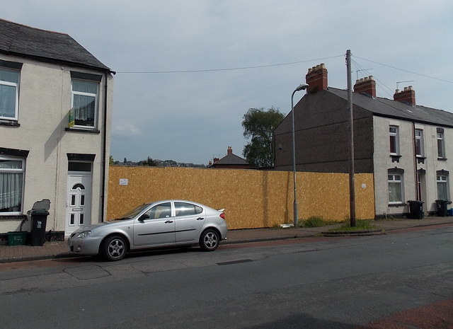
Image: © Jaggery Taken: 5 May 2014
Number 5 Dewstow Street is on left of the fenced-off gap, number 13 on the right. This was one row of houses until Luftwaffe bombing in August 1940 destroyed numbers 7, 9 and 11. The gap remains today (May 2014).
Images are licensed for reuse under creativecommons.org/licenses/by-sa/2.0
Image Location
Latitude
51.583302
Longitude
-2.973866