Charlton Village, London SE7
Introduction
The photograph on this page of Charlton Village, London SE7 by David Hallam-Jones as part of the Geograph project.
The Geograph project started in 2005 with the aim of publishing, organising and preserving representative images for every square kilometre of Great Britain, Ireland and the Isle of Man.

There are currently over 7.5m images from over 14,400 individuals and you can help contribute to the project by visiting https://www.geograph.org.uk
Charlton Village, London SE7
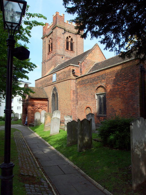
Image: © David Hallam-Jones Taken: 4 May 2014
The Grade II* listed Anglican church of St Luke-with-Holy-Trinity is seen here from near to the cluster of 'village' shops. The present building dates from the C17th. It is constructed of Kentish red bricks, probably made locally. New vestries were added in 1956.
Images are licensed for reuse under creativecommons.org/licenses/by-sa/2.0
Image Location
Latitude
51.48165
Longitude
0.035925