Riverside walkway near Finsborough Ness
Introduction
The photograph on this page of Riverside walkway near Finsborough Ness by Marathon as part of the Geograph project.
The Geograph project started in 2005 with the aim of publishing, organising and preserving representative images for every square kilometre of Great Britain, Ireland and the Isle of Man.

There are currently over 7.5m images from over 14,400 individuals and you can help contribute to the project by visiting https://www.geograph.org.uk
Riverside walkway near Finsborough Ness
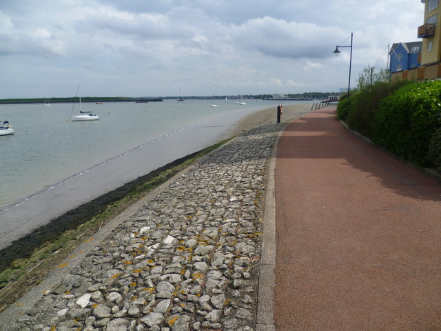
Image: © Marathon Taken: 24 Apr 2014
St Mary's Island, is part of the Chatham Maritime development area. By 1854, the whole of the island was in the hands of the Crown and the Royal Dockyard, Chatham. During the later years of the Royal Navy's time in occupation the area had consisted of a mixture of sports fields and warehousing. St.Mary's Island is divided from mainland Chatham by three basins used by the Dockyard. In 1984, the Dockyard was closed. In the late 1990s, English Partnerships and housing developer Countryside, came together to build homes on the island, under the development name Countryside Maritime. There are areas of raised parkland, but the real draw here are the views of the Medway Estuary opposite Lower Upnor and Hoo St Werburgh. In this view, Finsborough Ness is just around the corner and this is almost the eastern limit at the moment of development. The estuary continues around the uninhabited island to the left. The riverfront at Gillingham is in the distance. For more information see http://en.wikipedia.org/wiki/St_Mary's_Island,_Medway
Images are licensed for reuse under creativecommons.org/licenses/by-sa/2.0
Image Location
Latitude
51.407418
Longitude
0.548278