Caves in a sandstone cliff near Stourport, Worcestershire
Introduction
The photograph on this page of Caves in a sandstone cliff near Stourport, Worcestershire by Roger D Kidd as part of the Geograph project.
The Geograph project started in 2005 with the aim of publishing, organising and preserving representative images for every square kilometre of Great Britain, Ireland and the Isle of Man.

There are currently over 7.5m images from over 14,400 individuals and you can help contribute to the project by visiting https://www.geograph.org.uk
Caves in a sandstone cliff near Stourport, Worcestershire
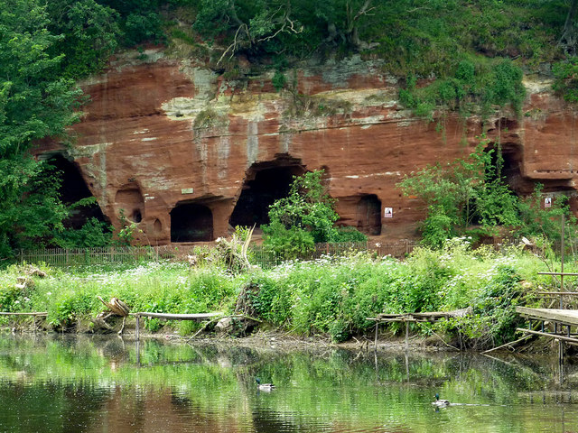
Image: © Roger D Kidd Taken: 21 Jun 2013
This cliff of Triassic Wildmoor Sandstone is on the western bank of the River Severn. The area has the unsurprising name of Redstone Rock. The site was used as a hermitage as far back as the 12th century, and was said to house up to 500 men, who may have also manned the ferry crossing, which was there due to the presence of a ford until the river was dredged. (Information from the Geodiversity Partnership http://www.geowestmidlands.org.uk/wiki/index.php5?title=Sites_to_Visit/Worcestershire )
Images are licensed for reuse under creativecommons.org/licenses/by-sa/2.0
Image Location
Latitude
52.327686
Longitude
-2.273616