The floods of Severn Stoke
Introduction
The photograph on this page of The floods of Severn Stoke by Bob Embleton as part of the Geograph project.
The Geograph project started in 2005 with the aim of publishing, organising and preserving representative images for every square kilometre of Great Britain, Ireland and the Isle of Man.

There are currently over 7.5m images from over 14,400 individuals and you can help contribute to the project by visiting https://www.geograph.org.uk
The floods of Severn Stoke
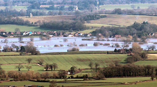
Image: © Bob Embleton Taken: 16 Feb 2014
The River Severn is flooded reaching up towards the A38 and the village. Viewed from Perseverance Hill on the Malverns. Beyond is Croome Court upper centre with the circular Panorama building on the left.
Images are licensed for reuse under creativecommons.org/licenses/by-sa/2.0
Image Location
Latitude
52.096944
Longitude
-2.209431