Aberystwyth, Marine Terrace: after the storm
Introduction
The photograph on this page of Aberystwyth, Marine Terrace: after the storm by Christopher Hilton as part of the Geograph project.
The Geograph project started in 2005 with the aim of publishing, organising and preserving representative images for every square kilometre of Great Britain, Ireland and the Isle of Man.

There are currently over 7.5m images from over 14,400 individuals and you can help contribute to the project by visiting https://www.geograph.org.uk
Aberystwyth, Marine Terrace: after the storm
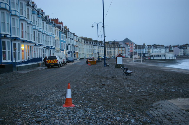
Image: © Christopher Hilton Taken: 14 Feb 2014
Thirty-six hours after 100mph winds passed through Aberystwyth on the night of 12/13 February 2014, shingle still covered the roads where the storm had cast it up.
Images are licensed for reuse under creativecommons.org/licenses/by-sa/2.0
Image Location


Leaflet Map data © OpenStreetMap
Latitude
52.417868
Longitude
-4.08428