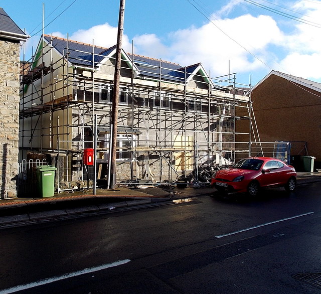
House construction in Penrhiwceiber
Introduction
The photograph on this page of House construction in Penrhiwceiber by Jaggery as part of the Geograph project.
The Geograph project started in 2005 with the aim of publishing, organising and preserving representative images for every square kilometre of Great Britain, Ireland and the Isle of Man.
There are currently over 7.5m images from over 14,400 individuals and you can help contribute to the project by visiting https://www.geograph.org.uk

Image: © Jaggery Taken: 4 Feb 2014
Viewed across Penrhiwceiber Road in early February 2014. The Google Earth Street View taken in November 2008 shows an area of grass here. I wondered what, if anything, had previously occupied the site. The clues are contradictory. The postbox suggests perhaps a post office, but the neighbouring houses are numbered 107 and 109 (108 is on the even-numbered opposite side of the road) which suggests a building without a number, maybe a chapel or church.

