Nottingham Canal and Colliery 1963
Introduction
The photograph on this page of Nottingham Canal and Colliery 1963 by Richard Bird as part of the Geograph project.
The Geograph project started in 2005 with the aim of publishing, organising and preserving representative images for every square kilometre of Great Britain, Ireland and the Isle of Man.

There are currently over 7.5m images from over 14,400 individuals and you can help contribute to the project by visiting https://www.geograph.org.uk
Nottingham Canal and Colliery 1963
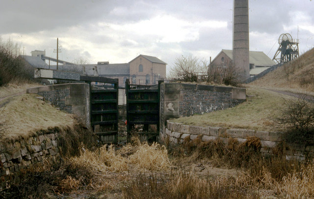
Image: © Richard Bird Taken: 21 Mar 1963
Accessed by way of Woodyard Lane, the Nottingham Canal climbed by a succession of locks to reach its summit level close by Wollaton Colliery. At this time, in 1963, many of the lock gates had been vandalised and many were missing. Today, it is hard to comprehend that this scene existed, since now the area has been covered by modern housing.
Images are licensed for reuse under creativecommons.org/licenses/by-sa/2.0
Image Location
Latitude
52.957893
Longitude
-1.223354