Looking across the Loose Valley from Teasaucer Hill
Introduction
The photograph on this page of Looking across the Loose Valley from Teasaucer Hill by Marathon as part of the Geograph project.
The Geograph project started in 2005 with the aim of publishing, organising and preserving representative images for every square kilometre of Great Britain, Ireland and the Isle of Man.

There are currently over 7.5m images from over 14,400 individuals and you can help contribute to the project by visiting https://www.geograph.org.uk
Looking across the Loose Valley from Teasaucer Hill
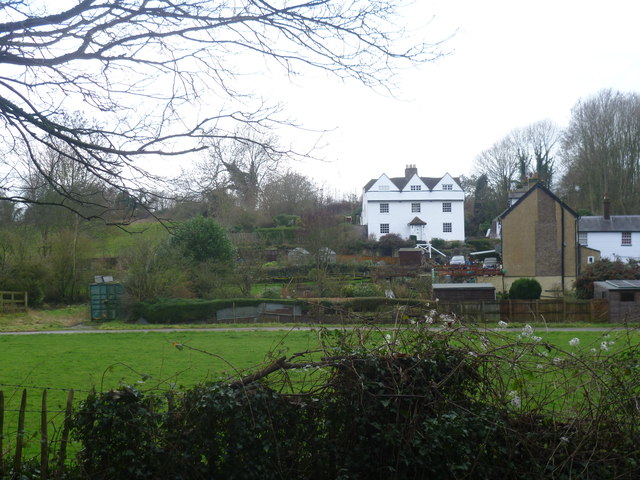
Image: © Marathon Taken: 18 Jan 2014
The Loose stream rises near Langley and flows into the river Medway near Tovil. For several hundred years until the early 20th century, the valley was a local centre of industry with a number of ragstone quarries and a series of 13 water-powered mills. The historian William Lambarde recorded that the mills all existed in 1570. At various times they were engaged in fulling woollen cloth, paper making and corn grinding. They have all either been demolished or long ceased working but the Loose Valley and the sites of the mills were designated a Conservation Area by Maidstone Borough Council in 2000. In this view from Teasaucer Hill, Bockingford Mill is on the extreme right. It seems to have been a fulling mill since at least the 17th century. The name of the hamlet probably stems from the word 'bucking' which meant a large wash of coarse linen. By 1839 it is thought that rags which were mostly brought down from London were washed and broken up here to be taken to Hayle Mill, a little way up the valley, for papermaking. By 1856 Bockingford Mill had become a corn mill and around 1900 it ceased operating and was converted into a house. It is now three dwellings and called Bockingford Mill Cottages.
Images are licensed for reuse under creativecommons.org/licenses/by-sa/2.0
Image Location
Latitude
51.254504
Longitude
0.51602