Dovecote at Burghill
Introduction
The photograph on this page of Dovecote at Burghill by Philip Halling as part of the Geograph project.
The Geograph project started in 2005 with the aim of publishing, organising and preserving representative images for every square kilometre of Great Britain, Ireland and the Isle of Man.

There are currently over 7.5m images from over 14,400 individuals and you can help contribute to the project by visiting https://www.geograph.org.uk
Dovecote at Burghill
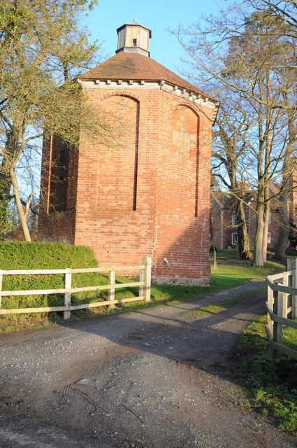
Image: © Philip Halling Taken: 11 Jan 2014
According to the British Listed Buildings website http://www.britishlistedbuildings.co.uk/en-154205-dovecote-approximately-50-metres-south-w this dovecote near Burghill Grange dates from 1717. It is a brick-built octagonal shape. It is situated by the entrance from the road to Burghill Grange.
Images are licensed for reuse under creativecommons.org/licenses/by-sa/2.0
Image Location
Latitude
52.095317
Longitude
-2.758718