Manchester Dry Docks.
Introduction
The photograph on this page of Manchester Dry Docks. by Chris Allen as part of the Geograph project.
The Geograph project started in 2005 with the aim of publishing, organising and preserving representative images for every square kilometre of Great Britain, Ireland and the Isle of Man.

There are currently over 7.5m images from over 14,400 individuals and you can help contribute to the project by visiting https://www.geograph.org.uk
Manchester Dry Docks.
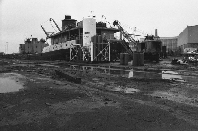
Image: © Chris Allen Taken: 15 Dec 1983
The stern section of SS Cliff Quay while being dismantled. There appears to be a ready supply of liquid oxygen available. This may have been to supply thermic lances for rapid cutting up of vessels.
Images are licensed for reuse under creativecommons.org/licenses/by-sa/2.0
Image Location


Leaflet Map data © OpenStreetMap
Latitude
53.470243
Longitude
-2.305773