View of the Romford skyline from the roof of the Brewery multi-storey car park
Introduction
The photograph on this page of View of the Romford skyline from the roof of the Brewery multi-storey car park by Robert Lamb as part of the Geograph project.
The Geograph project started in 2005 with the aim of publishing, organising and preserving representative images for every square kilometre of Great Britain, Ireland and the Isle of Man.

There are currently over 7.5m images from over 14,400 individuals and you can help contribute to the project by visiting https://www.geograph.org.uk
View of the Romford skyline from the roof of the Brewery multi-storey car park
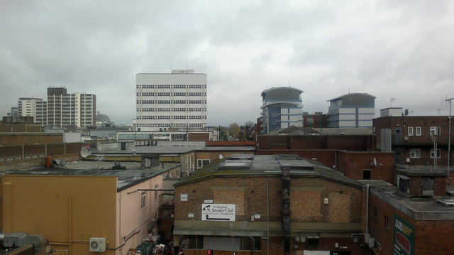
Image: © Robert Lamb Taken: 24 Nov 2013
Mercury House, the London Borough of Havering's council offices, is on the far left of the image. Next to this to the right is the Liberty shopping centre and the two blue and grey towerblocks are blocks of flats called Eldon Court and Halyards Court, on Western Road. The rear of shops on South Street can be seen in the foreground. Looking northeast.
Images are licensed for reuse under creativecommons.org/licenses/by-sa/2.0
Image Location
Latitude
51.57787
Longitude
0.185996