Abutment of dismantled railway bridge
Introduction
The photograph on this page of Abutment of dismantled railway bridge by Rose and Trev Clough as part of the Geograph project.
The Geograph project started in 2005 with the aim of publishing, organising and preserving representative images for every square kilometre of Great Britain, Ireland and the Isle of Man.

There are currently over 7.5m images from over 14,400 individuals and you can help contribute to the project by visiting https://www.geograph.org.uk
Abutment of dismantled railway bridge
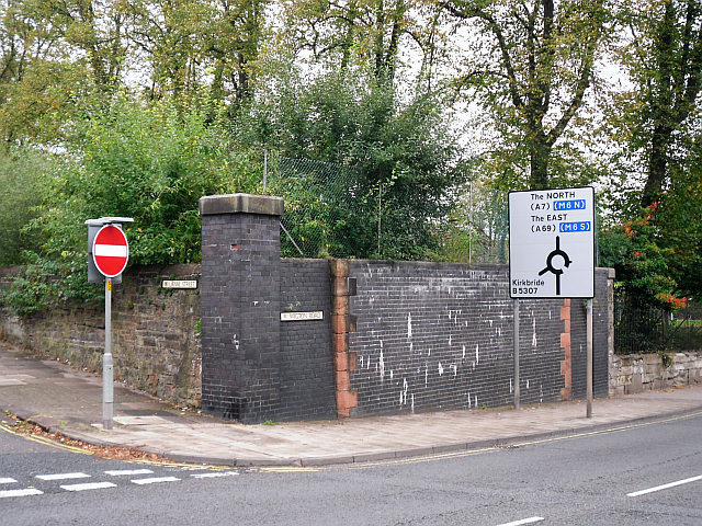
Image: © Rose and Trev Clough Taken: 24 Sep 2013
At the junction of Canal Street (left) and Wigton Road. The line here opened in 1837, as a goods extension from the Newcastle and Carlisle Railway's London Road depot to the Carlisle Canal basin. The bridge was rebuilt at least twice, following a collapse in 1875 and for road widening in the 1920s (see Cumberland News article 27.03.2009 http://www.cumberlandnews.co.uk/features/christmas/The-night-a-goods-train-took-the-plunge-0c1a8180-67ae-474c-b75c-f036b20090da-ds ). It ceased to be used after the Waverley Line closed in 1969, and was demolished in 1974. See also Image .
Images are licensed for reuse under creativecommons.org/licenses/by-sa/2.0
Image Location
Latitude
54.893034
Longitude
-2.950241