Single-file traffic over Fisher's Bridge, Stratford Road
Introduction
The photograph on this page of Single-file traffic over Fisher's Bridge, Stratford Road by Robin Stott as part of the Geograph project.
The Geograph project started in 2005 with the aim of publishing, organising and preserving representative images for every square kilometre of Great Britain, Ireland and the Isle of Man.

There are currently over 7.5m images from over 14,400 individuals and you can help contribute to the project by visiting https://www.geograph.org.uk
Single-file traffic over Fisher's Bridge, Stratford Road
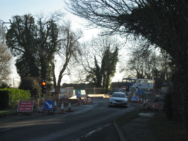
Image: © Robin Stott Taken: 1 Dec 2012
Contractors for the Environment Agency are constructing a new culvert under Stratford Road at Fisher's Bridge to alleviate flooding. Single file traffic operated over a long period. The reflective feature below centre is a temporary parapet Image The approach to the bridge is seen in Image
Images are licensed for reuse under creativecommons.org/licenses/by-sa/2.0
Image Location


Leaflet Map data © OpenStreetMap
Latitude
52.269962
Longitude
-1.597984