Cerrig-yr-Wyn
Introduction
The photograph on this page of Cerrig-yr-Wyn by Nigel Callaghan as part of the Geograph project.
The Geograph project started in 2005 with the aim of publishing, organising and preserving representative images for every square kilometre of Great Britain, Ireland and the Isle of Man.

There are currently over 7.5m images from over 14,400 individuals and you can help contribute to the project by visiting https://www.geograph.org.uk
Cerrig-yr-Wyn
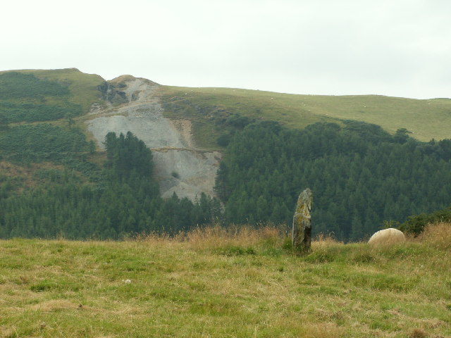
Image: © Nigel Callaghan Taken: 11 Aug 2005
One of the two standing stones called 'Cerrig-yr-Wyn', each about three ft high and about 200yds apart. Looking SW. The scar on the hillside opposite is the old Darren metal mine (in SN6782), which was originally worked in the mid 16th Cent. There is also the remains of a hill fort on top of the hill.
Images are licensed for reuse under creativecommons.org/licenses/by-sa/2.0
Image Location
Latitude
52.433612
Longitude
-3.935706