Old Barn at New Barn
Introduction
The photograph on this page of Old Barn at New Barn by Glyn Baker as part of the Geograph project.
The Geograph project started in 2005 with the aim of publishing, organising and preserving representative images for every square kilometre of Great Britain, Ireland and the Isle of Man.

There are currently over 7.5m images from over 14,400 individuals and you can help contribute to the project by visiting https://www.geograph.org.uk
Old Barn at New Barn
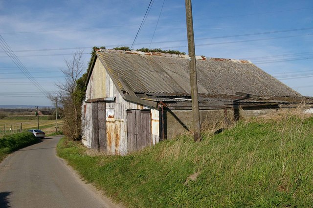
Image: © Glyn Baker Taken: 11 Mar 2007
This dilapidated farm building stands on a no through road in Spendiff. "Streetmap" claims this is off Castfield Close see http://www.streetmap.co.uk/newmap.srf?x=575685&y=174655&z=0&sv=TQ75687465&st=5&mapp=newmap.srf&searchp=newsearch.srf However locals tell me this road is unnamed and it is clearly not a close! There is an Oastfield Close nearby. Could this be one of the copyright theft errors used by map makers to prove cartographical plagiarism?
Images are licensed for reuse under creativecommons.org/licenses/by-sa/2.0
Image Location
Latitude
51.443593
Longitude
0.526546