One of Nathan's Cottages, or Colne Valley Sculpture Trail #10
Introduction
The photograph on this page of One of Nathan's Cottages, or Colne Valley Sculpture Trail #10 by Humphrey Bolton as part of the Geograph project.
The Geograph project started in 2005 with the aim of publishing, organising and preserving representative images for every square kilometre of Great Britain, Ireland and the Isle of Man.

There are currently over 7.5m images from over 14,400 individuals and you can help contribute to the project by visiting https://www.geograph.org.uk
One of Nathan's Cottages, or Colne Valley Sculpture Trail #10
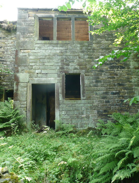
Image: © Humphrey Bolton Taken: 1 Aug 2013
According to English Heritage this is one of two mid 18C cottages with early 19C alterations. The south elevation has two 4-light and two 3-light double chamfered stone mullioned windows to the ground floor, and to the first floor two 8-light stone mullioned windows. There is also a late 18C cottage to the eastwith a 6-light stone mullioned window. To the north are vaulted stone outbuildings with datestone (possibly not in original location): H W M 1758. According to the Colne Valley Sculpture Trail (text copied from http://www.mapfodder.com/sculptureTrail.pdf ): "10: Queensgate Consultants- Proposal: Derelict House (Stone, slate, mortar, rubble) This, the largest work on the trail, is a house of recent construction whose sole purpose from the outset was to be derelict. This is typical of the work of Queensgate Consultants - an artists' co-operative from North London- whose "Proposals" are in fact completed works. They comment on built-in obsolescence by creating major pieces whose completion marks the end of their intended use. An inspection of the interior will reveal the level of detail they apply to this end."
Images are licensed for reuse under creativecommons.org/licenses/by-sa/2.0
Image Location
Latitude
53.610004
Longitude
-1.901266