Radnage Parish Church
Introduction
The photograph on this page of Radnage Parish Church by Des Blenkinsopp as part of the Geograph project.
The Geograph project started in 2005 with the aim of publishing, organising and preserving representative images for every square kilometre of Great Britain, Ireland and the Isle of Man.

There are currently over 7.5m images from over 14,400 individuals and you can help contribute to the project by visiting https://www.geograph.org.uk
Radnage Parish Church
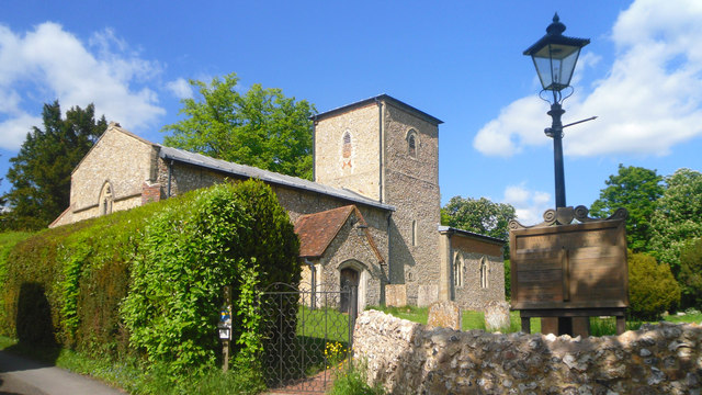
Image: © Des Blenkinsopp Taken: 3 Jun 2013
The church of St Mary the Virgin dates from around 1200. The name Radnage is derived from Old English Rodenache or Radeneach meaning Red Oak.
Images are licensed for reuse under creativecommons.org/licenses/by-sa/2.0
Image Location
Latitude
51.674832
Longitude
-0.864848