1960's photo of the High Street
Introduction
The photograph on this page of 1960's photo of the High Street by Dave Spicer as part of the Geograph project.
The Geograph project started in 2005 with the aim of publishing, organising and preserving representative images for every square kilometre of Great Britain, Ireland and the Isle of Man.

There are currently over 7.5m images from over 14,400 individuals and you can help contribute to the project by visiting https://www.geograph.org.uk
1960's photo of the High Street
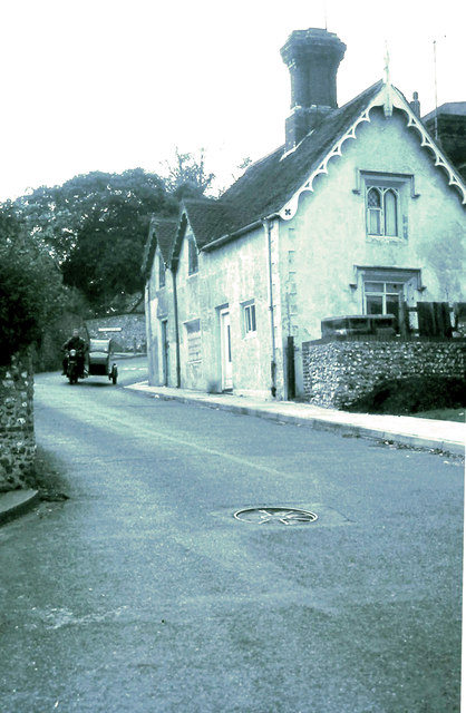
Image: © Dave Spicer Taken: Unknown
The cottages were demolished sometime in the late sixties most probably due to safety reasons as double decker buses used the road. Several times the over hanging tiles were removed by the buses on their descent. Photo Image shows the road in 2013 after other road improvements.
Images are licensed for reuse under creativecommons.org/licenses/by-sa/2.0
Image Location
Latitude
50.842674
Longitude
-0.222127