Barns at Wyke Farm
Introduction
The photograph on this page of Barns at Wyke Farm by Derek Harper as part of the Geograph project.
The Geograph project started in 2005 with the aim of publishing, organising and preserving representative images for every square kilometre of Great Britain, Ireland and the Isle of Man.

There are currently over 7.5m images from over 14,400 individuals and you can help contribute to the project by visiting https://www.geograph.org.uk
Barns at Wyke Farm
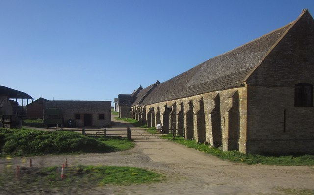
Image: © Derek Harper Taken: 29 Apr 2013
A grade II* listed row of C16 barns with buttresses http://list.english-heritage.org.uk/resultsingle.aspx?uid=1304035&searchtype=mapsearch , seen from a train between Yeovil Jct and Sherborne (the line cuts right through the farm). The barns are also shown in http://www.geograph.org.uk/search.php?i=41701710 .
Images are licensed for reuse under creativecommons.org/licenses/by-sa/2.0
Image Location
Latitude
50.929367
Longitude
-2.570256