Tumulus and Philiphaugh from Walkerdene House
Introduction
The photograph on this page of Tumulus and Philiphaugh from Walkerdene House by Wayne Phillips as part of the Geograph project.
The Geograph project started in 2005 with the aim of publishing, organising and preserving representative images for every square kilometre of Great Britain, Ireland and the Isle of Man.

There are currently over 7.5m images from over 14,400 individuals and you can help contribute to the project by visiting https://www.geograph.org.uk
Tumulus and Philiphaugh from Walkerdene House
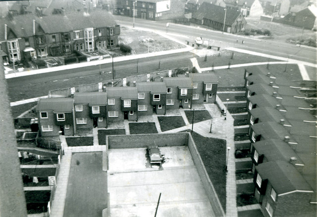
Image: © Wayne Phillips Taken: 1 Oct 1974
Aerial view taken from 14th Floor of Walkerdene House 1974. Pete Watsons shop visible at top of photograph. Demolition of the end of Philiphaugh just recent and road closed.
Images are licensed for reuse under creativecommons.org/licenses/by-sa/2.0
Image Location
Latitude
54.985206
Longitude
-1.539925