Crown House demolition
Introduction
The photograph on this page of Crown House demolition by Ian Capper as part of the Geograph project.
The Geograph project started in 2005 with the aim of publishing, organising and preserving representative images for every square kilometre of Great Britain, Ireland and the Isle of Man.

There are currently over 7.5m images from over 14,400 individuals and you can help contribute to the project by visiting https://www.geograph.org.uk
Crown House demolition
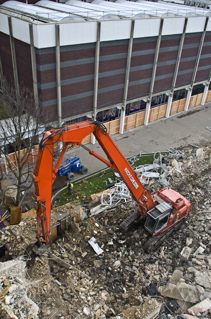
Image: © Ian Capper Taken: 22 Mar 2013
A demolition machine at work surrounded by the remains of Crown House, the building having been demolished prior to the redevelopment of Walnuts Square in 2013-14.
Images are licensed for reuse under creativecommons.org/licenses/by-sa/2.0
Image Location
Latitude
51.376817
Longitude
0.10181