Former crossing keeper's house, Lower Road
Introduction
The photograph on this page of Former crossing keeper's house, Lower Road by Marathon as part of the Geograph project.
The Geograph project started in 2005 with the aim of publishing, organising and preserving representative images for every square kilometre of Great Britain, Ireland and the Isle of Man.

There are currently over 7.5m images from over 14,400 individuals and you can help contribute to the project by visiting https://www.geograph.org.uk
Former crossing keeper's house, Lower Road
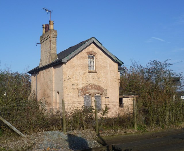
Image: © Marathon Taken: 5 Mar 2013
Next to the level crossing on the busy North Kent railway line between Teynham and Faversham, the old level crossing keeper's house is now derelict. The garden is completely overgrown and fenced in. The crossing has now been converted to half-barrier automatic operation.
Images are licensed for reuse under creativecommons.org/licenses/by-sa/2.0
Image Location
Latitude
51.322948
Longitude
0.838425