Mill Place
Introduction
The photograph on this page of Mill Place by Ian Capper as part of the Geograph project.
The Geograph project started in 2005 with the aim of publishing, organising and preserving representative images for every square kilometre of Great Britain, Ireland and the Isle of Man.

There are currently over 7.5m images from over 14,400 individuals and you can help contribute to the project by visiting https://www.geograph.org.uk
Mill Place
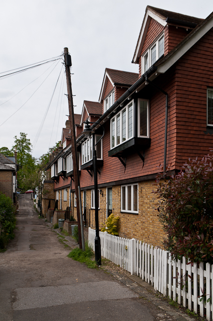
Image: © Ian Capper Taken: 17 May 2012
Mill Place links Old Hill and Summer Hill, its name referring to a windmill that once stood nearby, built in 1796 but demolished in 1868. This view is looking towards Old Hill in the background. On the right is the rear of buildings in Eugenie Mews. These were built on the site of St John's Church, a chapel of ease of St Nicholas' Church built in 1886 and in use until 1933, after which it was used for industrial purposes until demolition in 1998. The name Eugenie Mews commemorates the Empress Eugenie, wife of Napoleon III, who lived at Camden Place following the Emperor's exile from France in 1871. For view of the entrance to the Mews, see Image
Images are licensed for reuse under creativecommons.org/licenses/by-sa/2.0
Image Location
Latitude
51.408737
Longitude
0.062105