Spinningfields Footbridge
Introduction
The photograph on this page of Spinningfields Footbridge by David Dixon as part of the Geograph project.
The Geograph project started in 2005 with the aim of publishing, organising and preserving representative images for every square kilometre of Great Britain, Ireland and the Isle of Man.

There are currently over 7.5m images from over 14,400 individuals and you can help contribute to the project by visiting https://www.geograph.org.uk
Spinningfields Footbridge
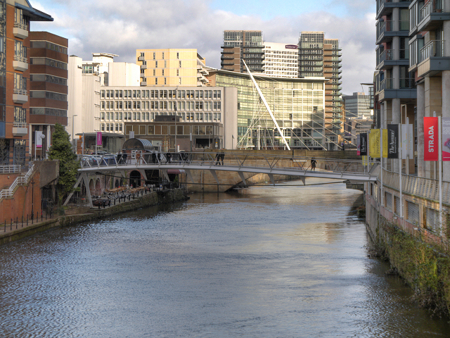
Image: © David Dixon Taken: 6 Feb 2013
The River Irwell, has always marked the invisible border between the Cities of Manchester and Salford. Here, we are looking upstream from the bridge at New Quay Street Image] . Ahead, is the new footbridge, which was opened in January 2012 (http://www.manchesterconfidential.co.uk/News/New-City-Centre-Footbridge-Lands report, Manchester Confidential) and is the latest part of the Irwell River Park Programme, providing a direct gateway between the New Bailey area of Salford Central and Spinningfields in Manchester.
Images are licensed for reuse under creativecommons.org/licenses/by-sa/2.0
Image Location
Latitude
53.48115
Longitude
-2.254618