Floating Harbour, Bristol, 1966
Introduction
The photograph on this page of Floating Harbour, Bristol, 1966 by Derek Harper as part of the Geograph project.
The Geograph project started in 2005 with the aim of publishing, organising and preserving representative images for every square kilometre of Great Britain, Ireland and the Isle of Man.

There are currently over 7.5m images from over 14,400 individuals and you can help contribute to the project by visiting https://www.geograph.org.uk
Floating Harbour, Bristol, 1966
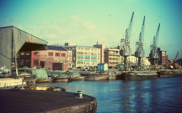
Image: © Derek Harper Taken: Unknown
Where the cranes are is now a car park with trees. Behind are buildings on The Grove. The brick building to the left is listed as Severn Shed, and known as Hide Shed: "The last surviving part of a scheme of quayside transit shed accommodation which extended along Redcliff Wharf and Broad Quay"; it now houses the Mud Dock - see Image and Image
Images are licensed for reuse under creativecommons.org/licenses/by-sa/2.0
Image Location
Latitude
51.448171
Longitude
-2.595693