Site of Chesterfield Central station, along Brimington Road from Malkin Street, 1989
Introduction
The photograph on this page of Site of Chesterfield Central station, along Brimington Road from Malkin Street, 1989 by Ben Brooksbank as part of the Geograph project.
The Geograph project started in 2005 with the aim of publishing, organising and preserving representative images for every square kilometre of Great Britain, Ireland and the Isle of Man.

There are currently over 7.5m images from over 14,400 individuals and you can help contribute to the project by visiting https://www.geograph.org.uk
Site of Chesterfield Central station, along Brimington Road from Malkin Street, 1989
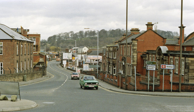
Image: © Ben Brooksbank Taken: 23 Mar 1989
The view is northward and the entrance to the ex-Great Central Railway Central station had been off on the left: the 'Station' sign is for the only remaining Chesterfield station - the former Midland station. Since this photograph was taken a new trunk A61 road has been constructed (off to the left here) partly along the course of the ex-GC Chesterfield Loop of the GC main line between Nottingham and Sheffield. The Loop and its stations were closed effectively from 4/3/63, but goods continued to be dealt with at Chesterfield Central until 11/9/67.
Images are licensed for reuse under creativecommons.org/licenses/by-sa/2.0
Image Location
Latitude
53.238769
Longitude
-1.422506