St Pauls Church
Introduction
The photograph on this page of St Pauls Church by Ian Capper as part of the Geograph project.
The Geograph project started in 2005 with the aim of publishing, organising and preserving representative images for every square kilometre of Great Britain, Ireland and the Isle of Man.

There are currently over 7.5m images from over 14,400 individuals and you can help contribute to the project by visiting https://www.geograph.org.uk
St Pauls Church
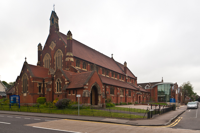
Image: © Ian Capper Taken: 26 Jun 2012
Built in 1910, replacing a nearby mission church built in 1899 to serve this expanding part of St Albans. The hall extension on the right, which also saw the reordering of the church itself, was completed in 2010.
Images are licensed for reuse under creativecommons.org/licenses/by-sa/2.0
Image Location
Latitude
51.75252
Longitude
-0.319248