Shirehampton Tide Gate, Bristol
Introduction
The photograph on this page of Shirehampton Tide Gate, Bristol by Jaggery as part of the Geograph project.
The Geograph project started in 2005 with the aim of publishing, organising and preserving representative images for every square kilometre of Great Britain, Ireland and the Isle of Man.

There are currently over 7.5m images from over 14,400 individuals and you can help contribute to the project by visiting https://www.geograph.org.uk
Shirehampton Tide Gate, Bristol
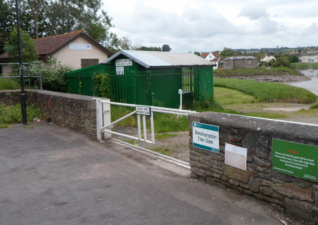
Image: © Jaggery Taken: 23 Jun 2012
Viewed from Station Road. The tide gate is on the NE bank of the River Avon. The tides reach here from the Bristol Channel via the River Severn. The notice on the right states that the tide gate will be closed from 3 hours before until 1 hour after high tides in excess of 7.3 metres A.O.D. (including surge). A.O.D. is the abbrevation for above ordnance datum, which in the UK is defined as the mean sea level at Newlyn (Cornwall) between 1915 and 1921. In the background are Shirehampton Sailing Club buildings. http://www.geograph.org.uk/photo/3297680
Images are licensed for reuse under creativecommons.org/licenses/by-sa/2.0
Image Location
Latitude
51.483303
Longitude
-2.682701