Oadby, Leics LE2
Introduction
The photograph on this page of Oadby, Leics LE2 by David Hallam-Jones as part of the Geograph project.
The Geograph project started in 2005 with the aim of publishing, organising and preserving representative images for every square kilometre of Great Britain, Ireland and the Isle of Man.

There are currently over 7.5m images from over 14,400 individuals and you can help contribute to the project by visiting https://www.geograph.org.uk
Oadby, Leics LE2
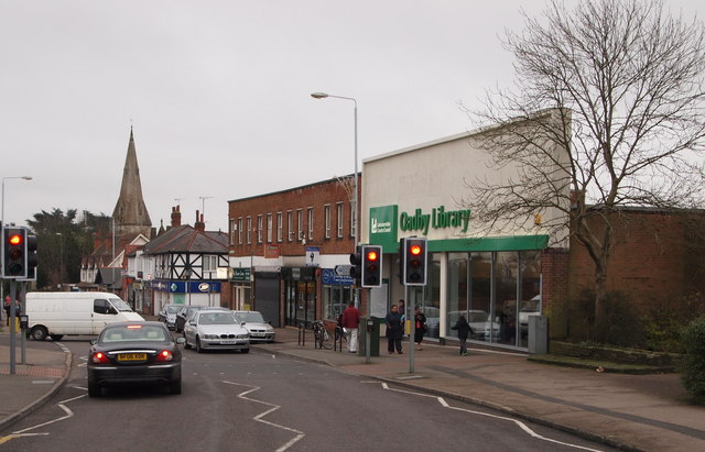
Image: © David Hallam-Jones Taken: 7 Jan 2013
Although some street plans continue to show the local library as being adjacent to the large public car park at the closed end of Sandhurst Street (a cul-de-sac), in what has now become a community centre, the library has evidently transferred to this new building on Leicester Road. This is the view towards St Peter's Church where Leicester Road joins London Road (the B5403).
Images are licensed for reuse under creativecommons.org/licenses/by-sa/2.0
Image Location
Latitude
52.598472
Longitude
-1.083263